
|
Lot: 233 ♡
|
|||||||||||
|
Map: Virginiae partis australis et Floridiae partis orientalis, interjacentium. regionum NOVA DESCRIPTIO.
|
|||||||||||
|
|
|||||||||||
 |
|
||||||||||
|
Lot 233:
Map: Virginiae partis australis et Floridiae partis orientalis, interjacentium. regionum NOVA DESCRIPTIO.
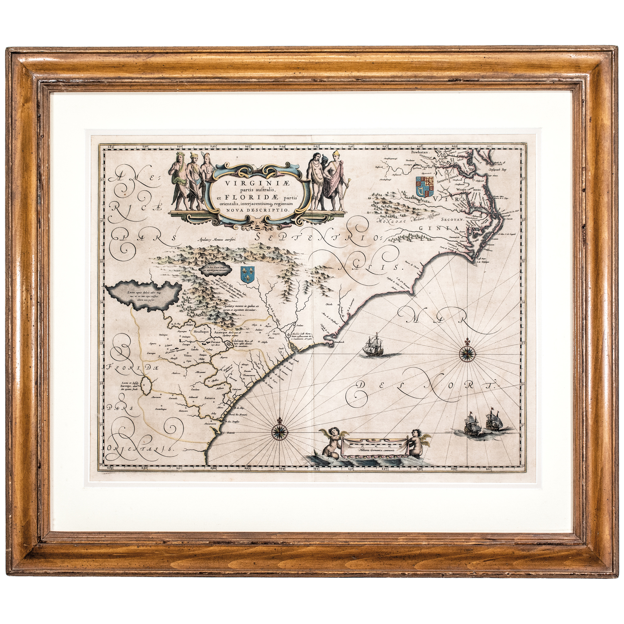
(1640) Map: Virginiae partis australis et Floridiae partis orientalis, interjacentium. regionum NOVA DESCRIPTIO. by Willem BLAEU (1571-1638), Amsterdam, Double-Page Copper-Plate Engraving with original period Hand-Color, Framed, Choice Very Fine or better. An important superior quality early Dutch map of southeastern America: this copy with the full original Copper-Plate outline impression seen on all sides of its laid period paper, measuring 16 x 20 inches (by sight) double-matted with additional marginal selvage covered by the wide mat. It covers the Atlantic coast from the Chesapeake Bay in the north down to northern Florida. Framed as shown to fully 24.5 x 28.25 inches in a wood frame displayed under glass. (Not viewed out of its frame.) The Hand-Coloring is strong and attractive, there are faint signs of the correct Latin text being printed on the verso. True to the Dutch Golden Age style, this map is richly decorated with an elaborate cartouche flanked by Native American figures, compass roses, sailing ships, and sea monsters. First published around 1635-1639, this map was considered the most accurate depiction of the region until the early 18th century. This is the second state of Blaeu's map of the southeastern portion of North America. The map depicts the region from present day northern Florida to Chesapeake Bay. France is shown as governing the southern portion of this land (though they had been forced out in fact some time before by the Spanish) and Great Britain as ruler of the northeast. This map illustrates competing colonial interests. The Royal Arms of England are placed over Virginia, while the Fleur-de-lis of France marks Florida, referencing French colonization attempts in the 1560s like Fort Caroline. As pointed out by Burden, this map improves on the Hondius-Mercator map of the same region in its depiction of the Outer Banks and in its inclusion of the Chesapeake Bay, and it provided the best depiction of the region until 1700. Its handsome cartouche surrounded by full figure Native Americans and its elaborate calligraphy contribute to make it one of the most artistically successful maps of 17th century America. Overall, a very attractive map with sharp details, great color and eye appeal ready to hang on display. |
|||||||||||
|
Auction Closing: Saturday, April 18th
at Noon Eastern Time • 9:00 AM Pacific Time |
|||||||||||