
|
Lot: 235 ♡
|
|||||||||||
|
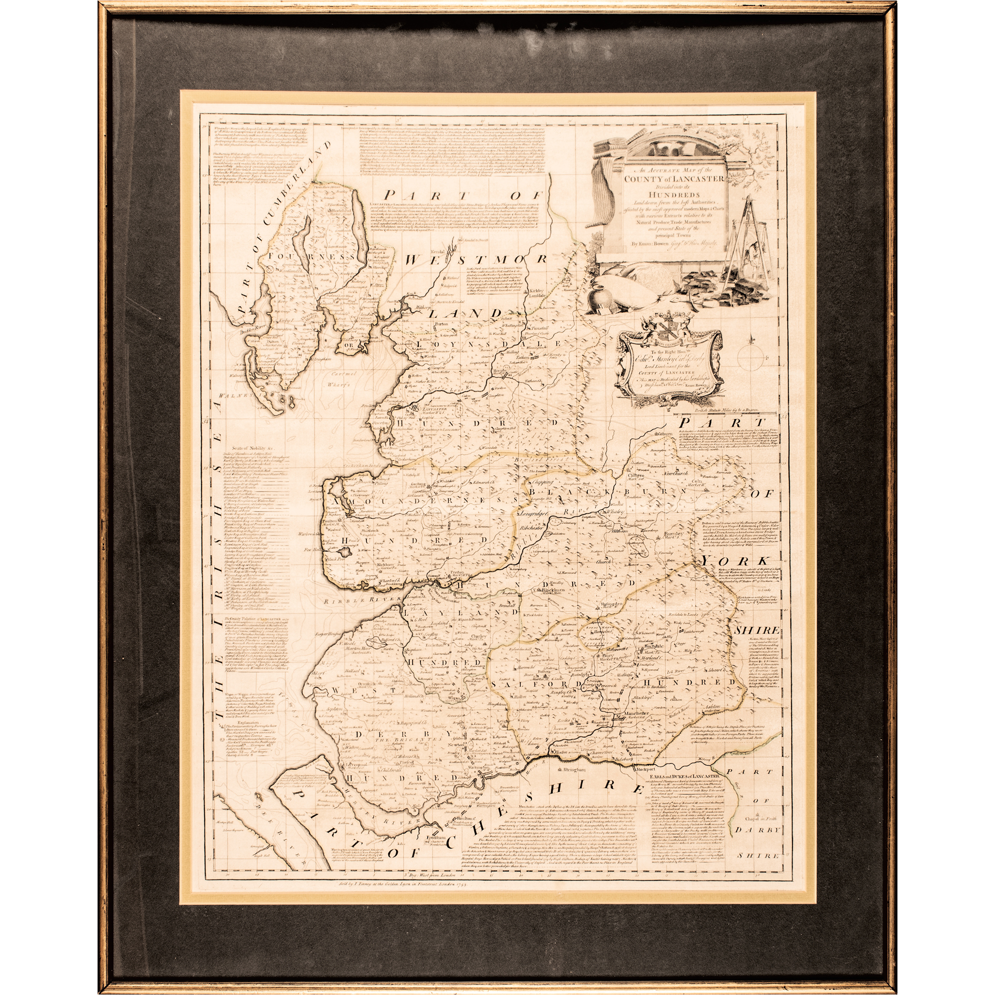
1753 Royal Mapmaker Emanuel Bowen’s “An Accurate Map of the County of Lancaster Divided into its Hundreds”
|
|||||||||||
|
|
|||||||||||
 |
|
||||||||||
|
Lot 235:
1753 Royal Mapmaker Emanuel Bowen’s “An Accurate Map of the County of Lancaster Divided into its Hundreds”
1753-Dated, Hand-Colored Copper-Engraved Map titled: “An Accurate Map of the County of Lancaster Divided into its Hundreds”, engraved by the Royal Mapmaker to both to King George II of Great Britain and Louis XV of France, Emanuel Bowen, England, Framed, Choice Very Fine. An intricate Copper-Plate Engraved Map with excellent details and Hand-Colored yellow and green outlines. It measures about 22” x 28” (by sight), double-matted in a simple burnt-gold painted wooden frame displayed under special UV Plexiglas. Measuring fully to 28” x 35” it is fully titled: “An accurate map of the County of Lancaster divided into its hundreds, laid down from the best authorities: assisted by the most improved modern maps & charts with various extracts relative to its natural produce, trade, manufactures... by Eman: Bowen Geogr. to His Majesty.” (As the Royal Mapmaker to King George II of Great Britain.) Sharply engraved and printed having minor expected even age tone with attractive eye appeal. Emanuel Bowen (1694-1767) was a Welsh map engraver, who achieved the unique distinction of becoming Royal Mapmaker to both to King George II of Great Britain and Louis XV of France. Bowen was highly regarded by his contemporaries for producing some of the largest, most detailed and most accurate maps of his era. He is known to have worked with most British cartographic figures of the period including John Owen and Herman Moll. |
|||||||||||
|
Auction Closing: Saturday, April 18th
at Noon Eastern Time • 9:00 AM Pacific Time |
|||||||||||