
|
Lot: 236 ♡
|
|||||||||||
|
French & Indian War Era Map of the Hudson River Valley
|
|||||||||||
|
|
|||||||||||
 |
|
||||||||||
|
Lot 236:
French & Indian War Era Map of the Hudson River Valley
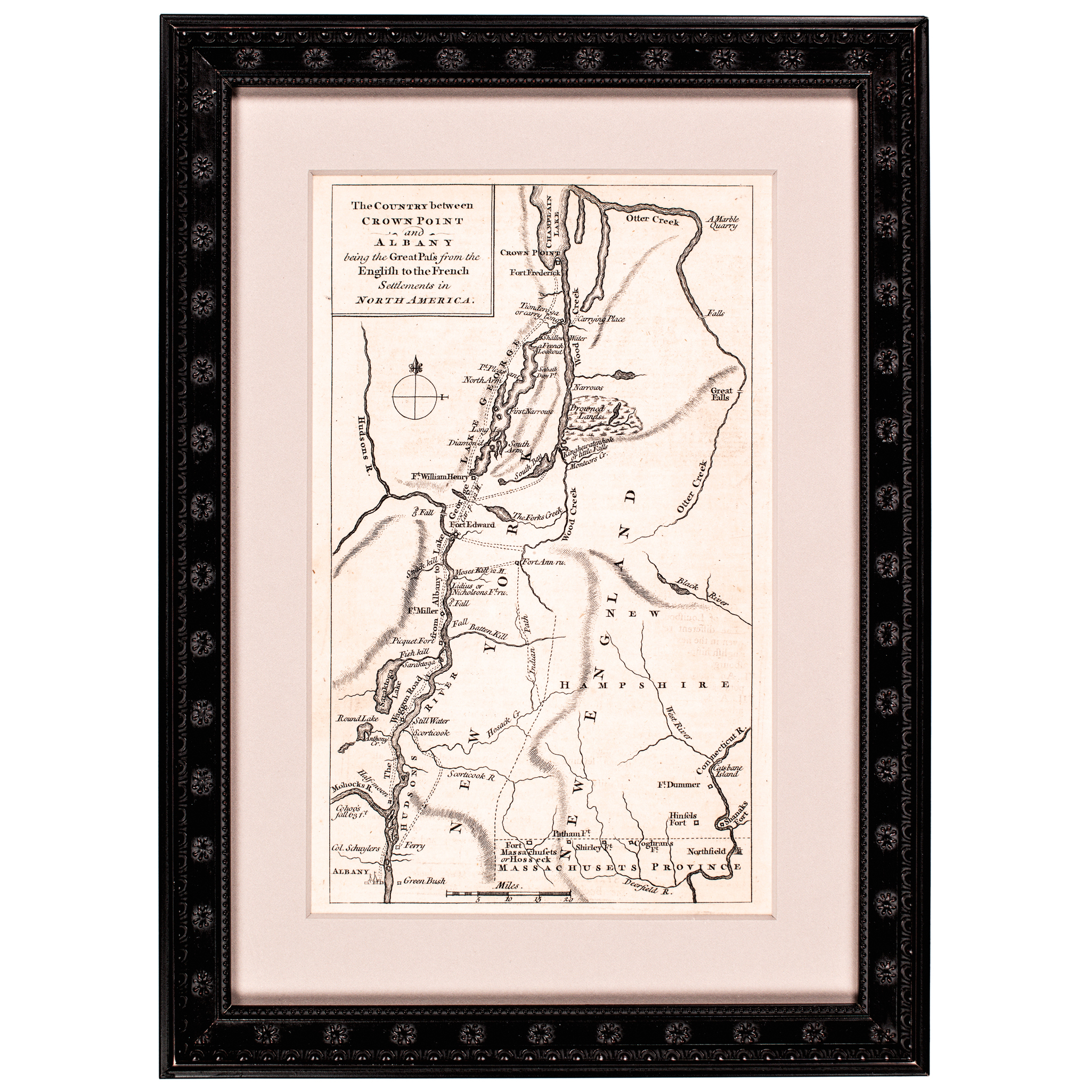
c. 1758 French and Indian War Period Map titled, "The Country between Crown Point and Albany being the Great Pass from the English to the French Settlements in North America." engraved by Thomas Phinn, Framed, Choice Crisp Mint. An exceptional and historically important 1758 engraved map titled, “The Country Between Crown Point and Albany Being the Great Pass From the English to the French Settlements in North America.” This scarce French & Indian War-period map measure about 4.75 x 7.75 (by sight) and 8 x 10.75 inches framed. This map depicts the strategic Hudson River corridor between Crown Point and Albany, illustrating the critical military passage contested by British and French forces in North America. This map was engraved by Thomas Phinn in 1758 for Volume 20 of “Scots Magazine” On wove paper. This engraving exhibits sharp detail and strong visual clarity, characteristic of mid-18th century British cartographic works. This map is professionally modern matted and framed, presenting beautifully for display under special UV Plexiglas in an ornate mahogany styled frame. Overall condition is excellent for the period, with attractive presentation and strong eye appeal. An increasingly scarce French and Indian War cartographic engraving. Museum quality and highly desirable for advanced collectors of early American maps, military history, and 18th century printed works The Hudson River Valley shown here was a vital strategic corridor during the conflict known in America as the French and Indian War, part of the larger global struggle between Britain and France. |
|||||||||||
|
Auction Closing: Saturday, April 18th
at Noon Eastern Time • 9:00 AM Pacific Time |
|||||||||||