
|
Lot: 199 ♡
|
|||||||||||
|
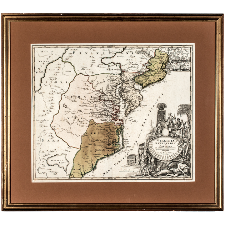
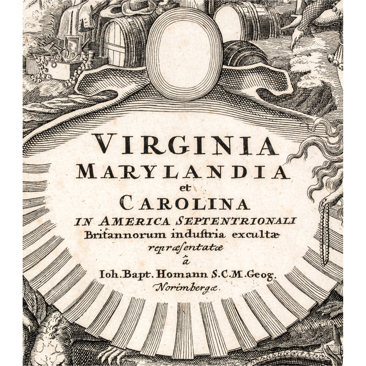
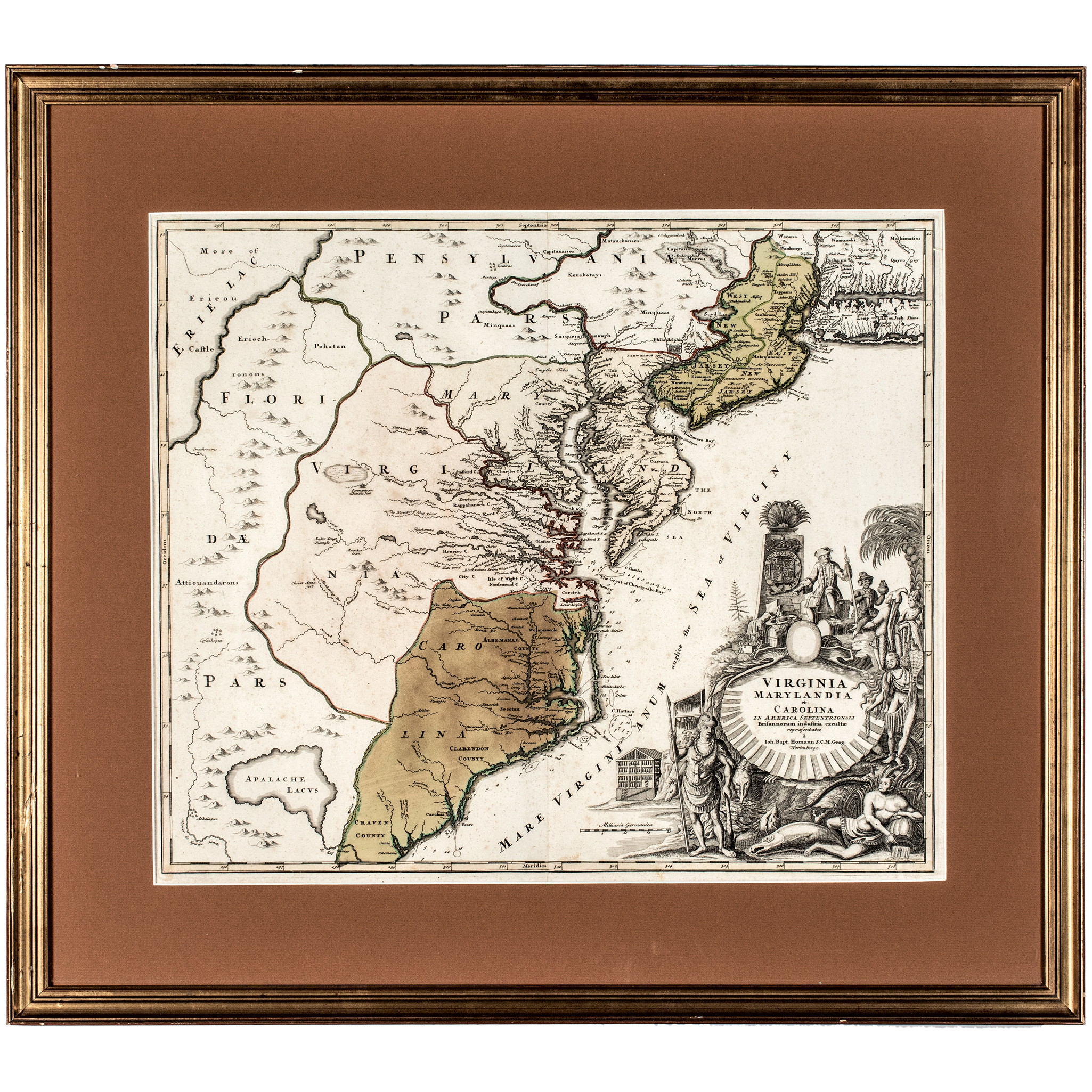
c. 1714 Hand-Colored Engraved Map Titled "Virginia Marylandia et Carolina in America Septentrionali," by Johann Baptist Homann
|
|||||||||||
|
|||||||||||
 |
|
||||||||||
|
Lot 199:
c. 1714 Hand-Colored Engraved Map Titled "Virginia Marylandia et Carolina in America Septentrionali," by Johann Baptist Homann
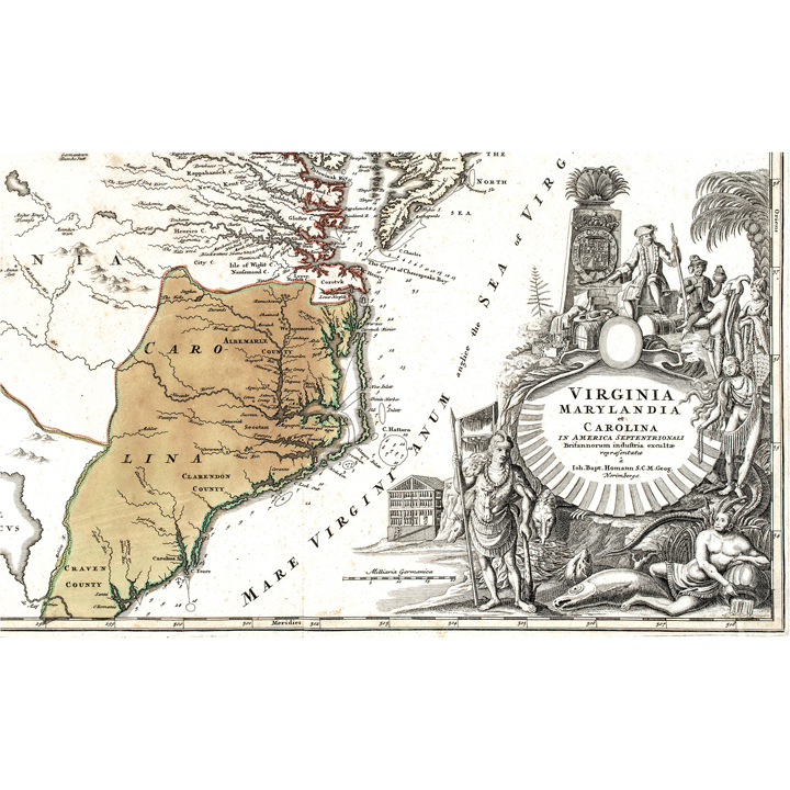
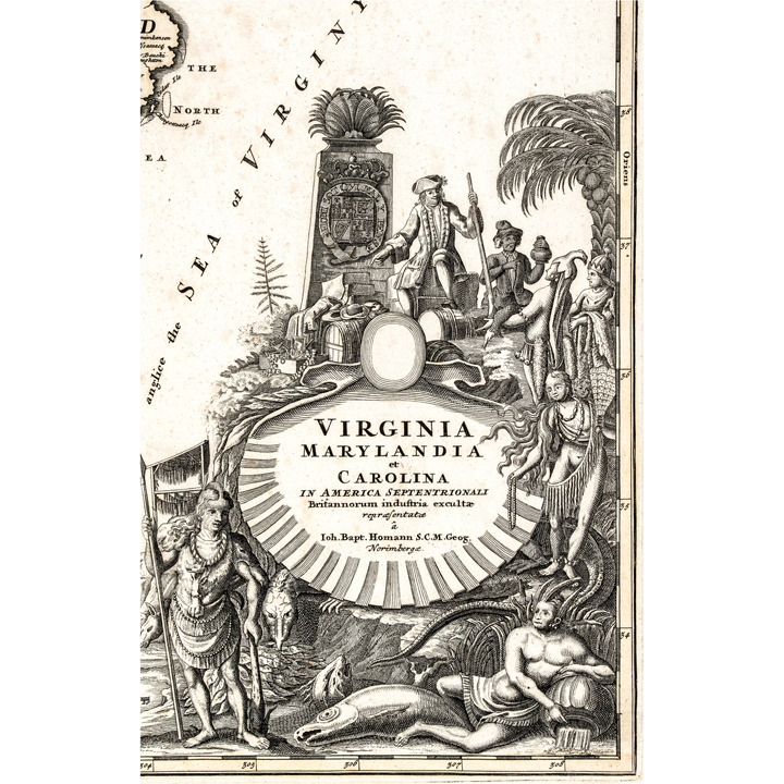
c. 1714 Hand-Colored Engraved Map Titled "Virginia Marylandia et Carolina in America Septentrionali," Published by Johann Baptist Homann of Depicting the Mid-Atlantic Coast from Pennsylvania and New Jersey Through Virginia and the Carolinas, Nuremberg, Germany, Framed, Very Fine. An important very early Colonial Era Hand-Colored Engraved Map measuring 31.5 x 28 inches Framed and 19 x 23 inches (by sight) titled, "Virginia Marylandia et Carolina in America Septentrionali, Britannorum industria exculta repraesentata,..." published by Johann Baptist Homann of Nuremberg. This German cartographer whose firm produced some of this most widely circulated and decoratively ambitious maps of colonial America in this early 18th century. This map covers this Mid-Atlantic coast in considerable detail, stretching from Pennsylvania, West and East Jersey, and Lake Erie in this north down through Maryland, Virginia, and this Carolinas, with county boundaries, river systems, Native settlements, and colonial towns all carefully rendered and outlined in period hand coloring. This map's most striking feature sits in this lower right corner, an elaborate allegorical cartouche framing this title, populated with Native American figures in feathered dress, colonial trade goods including barrels and casks, tobacco leaves, and a reclining figure atop an alligator, this whole scene meant to celebrate British commercial and colonial enterprise in this New World, as this Latin subtitle declares, "represented through British industry." This map circulated widely throughout Europe in this early 18th century and remains one of this most recognizable and decoratively desirable depictions of colonial Virginia, Maryland, and this Carolinas from this period, prized as much for its cartographic detail as for this artistry of its cartouche. Presented here handsomely framed and ready for display. [Colonial America, 18th Century America, Pre-Revolutionary War] [Cartography, Native American History, Colonial Trade] [Maps, Engravings, European Imprints] |
|||||||||||
|
Auction Closing: Saturday, August 29th
at Noon Eastern Time • 9:00 AM Pacific Time |
|||||||||||