
|
Lot: 202 ♡
|
|||||||||||
|
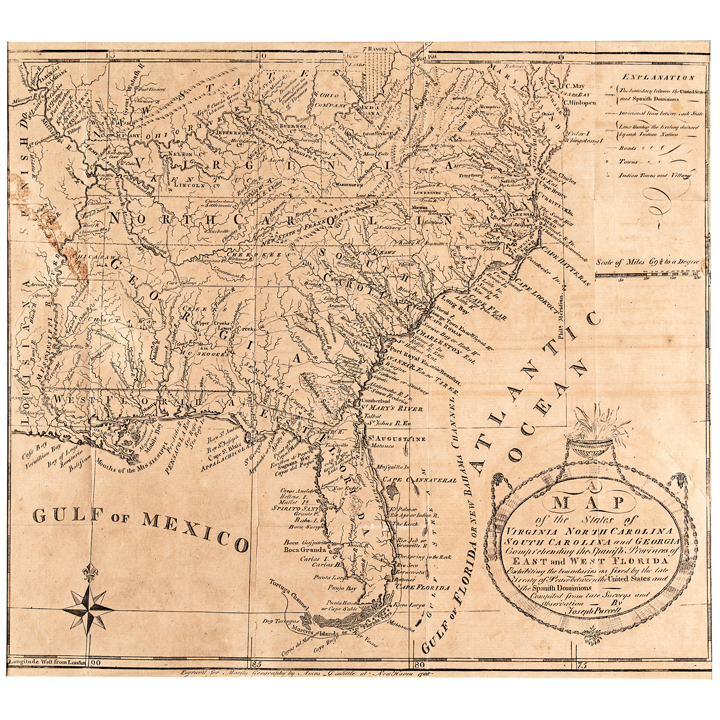
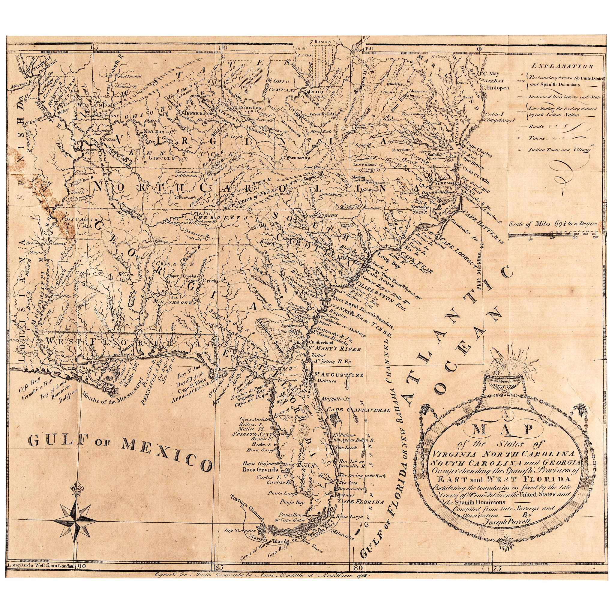
1788 A MAP of the States of Virginia, North & South Carolina, Georgia, and Spanish East & West Florida by Joseph Purcell Engraved by Amos Doolittle of New Haven
|
|||||||||||
|
|||||||||||
 |
|
||||||||||
|
Lot 202:
1788 A MAP of the States of Virginia, North & South Carolina, Georgia, and Spanish East & West Florida by Joseph Purcell Engraved by Amos Doolittle of New Haven
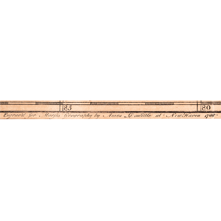
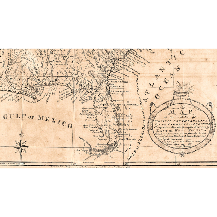
1788-Dated Federal Period First edition, “A MAP of the States of Virginia, North Carolina, South Carolina and Georgia, Comprehending the Spanish Provinces of East and West Florida, Compiled by Joseph Purcell, Engraved for Morse's Geography by Amos Doolittle, New Haven, often called "the Paul Revere of Connecticut", First Edition, Matted, Very Fine. This Copper-Plate Engraved Map, is printed in black on laid period paper. It measures about 13” x 14.25” (by sight) presented matted fully to 21.5” x 22.5”. First edition, bearing the imprint "Engrav'd for Morse's Geography by Amos Doolittle at New Haven, 1788" beneath the bottom border, compiled by Joseph Purcell and first published in Jedidiah Morse's American Geography and in the August 1788 issue of the American Magazine. The true 1788 and only Amos Doolittle printing is an American-engraved map from the earliest years of American cartographic publishing and is the most desirable to collectors of American-made maps. These is a short fine 2.5” split at the upper left edge that has been stabilized with old tape on the blank verso leaving some see-through and has some folds and general even overall tone as shown. Amos Doolittle (1754-1832) was a self-taught New Haven engraver, silversmith, and printmaker, often called "the Paul Revere of Connecticut" for his pioneering work in early American copper-plate engraving. He is best remembered for his famous 1775 series of four engravings depicting the Battles of Lexington and Concord, based on original sketches by Ralph Earl, and later on-site visits shortly after the fighting. This series stands among the earliest American historical prints and are now highly prized major rarities. Over his long career in New Haven, Amos Doolittle produced a prolific body of maps, portraits, book illustrations, bookplates, currency, Fugio cent restrikes and music engravings, making him one of the most important engravers of the Federal era. The imprint below the bottom border that reads: "Engrav'd for Morse's Geography by Amos Doolittle at New Haven, 1788" confirms it as the rare American first edition by Doolittle. “A MAP of the States of Virginia, North Carolina, South Carolina, and Georgia together with the Spanish provinces of East and West Florida, Exhibiting the boundaries as fixed by the late Treaty of Peace between the United States and the Spanish Dominions ---- Compiled from late Surveys and Observation - By Joseph Purcell.” This following the 1783 Treaty, along with state and territorial divisions, roads, towns, and Indian nation boundaries per the printed key. Of particular note to collectors, this map records the short-lived "New State of Franklin" in western North Carolina, being an unrecognized “breakaway State” that existed only from 1784 to 1788, before reabsorption by North Carolina. This historic Map is one of only a small number of period-printed maps to document the “New State of Franklin's” brief existence at all. Compiled by Irish-American surveyor Joseph Purcell, who trained under William Gerard De Brahm and later worked in the British Indian Department under John Stuart, this map draws on Purcell's firsthand surveying experience in the Southeast. This Map stands as the only one of his maps ever to have it print appearing in Morse's influential early American geography text. A well detailed example. See: Wheat & Brun #491/494. The 1788 First Early State of Purcell's finely engraved Map of the Southeastern United States was composed in the early years following the American Revolution. This Map includes an early reference to the "New State of Franklin" and the West and South are highly detailed with Native American towns, roads, and the claims of the New Jersey Company, the Illinois Company, etc. It is one of the few maps to record the short-lived state of "Franklinia" (Franklin), the settler state formed in 1784 that was never recognized by Congress. It shows the boundaries between the US and Spanish dominions, Indian nations and trade paths, towns, roads, the Seven Ranges, and the Ohio, New Jersey, and Illinois Company lands. It's referenced as Wheat & Brun #491/494, and it has the distinction of being among the first maps of the region compiled by an American surveyor working from firsthand knowledge. This Map first appeared in Jedidiah Morse's Geography book, referenced in the imprint, and also in the August 1788 issue of the American Magazine. The Map was later reissued in London in 1792 is not by Amos Doolittle rather the second bears a "John Stockdale Jan. 25th, 1792" and the third edition is an “unattributed” edition was possibly published in New York. The imprint below the bottom border that reads: "Engrav'd for Morse's Geography by Amos Doolittle at New Haven, 1788" confirms it as the American first edition by Doolittle. [Federal Period, Early Republic, 18th Century America] [Cartography, American Geography] [Maps, Engravings, Prints] |
|||||||||||
|
Auction Closing: Saturday, August 29th
at Noon Eastern Time • 9:00 AM Pacific Time |
|||||||||||